Trail Maps
TRAIL INFO
Currently there are 5 trailheads accessible from the Greenways by mountain bike trails. There is also 1 paved trail. All located on the Greenways property.
The main trailhead is the Santos Trailhead. Traveling southeast on the trails from there are the Vortex, LandBridge, 49th Avenue and Ross Prairie trailheads. The Baseline trailhead is a paved loop located off Baseline Road.
The main trailhead is the Santos Trailhead. Traveling southeast on the trails from there are the Vortex, LandBridge, 49th Avenue and Ross Prairie trailheads. The Baseline trailhead is a paved loop located off Baseline Road.
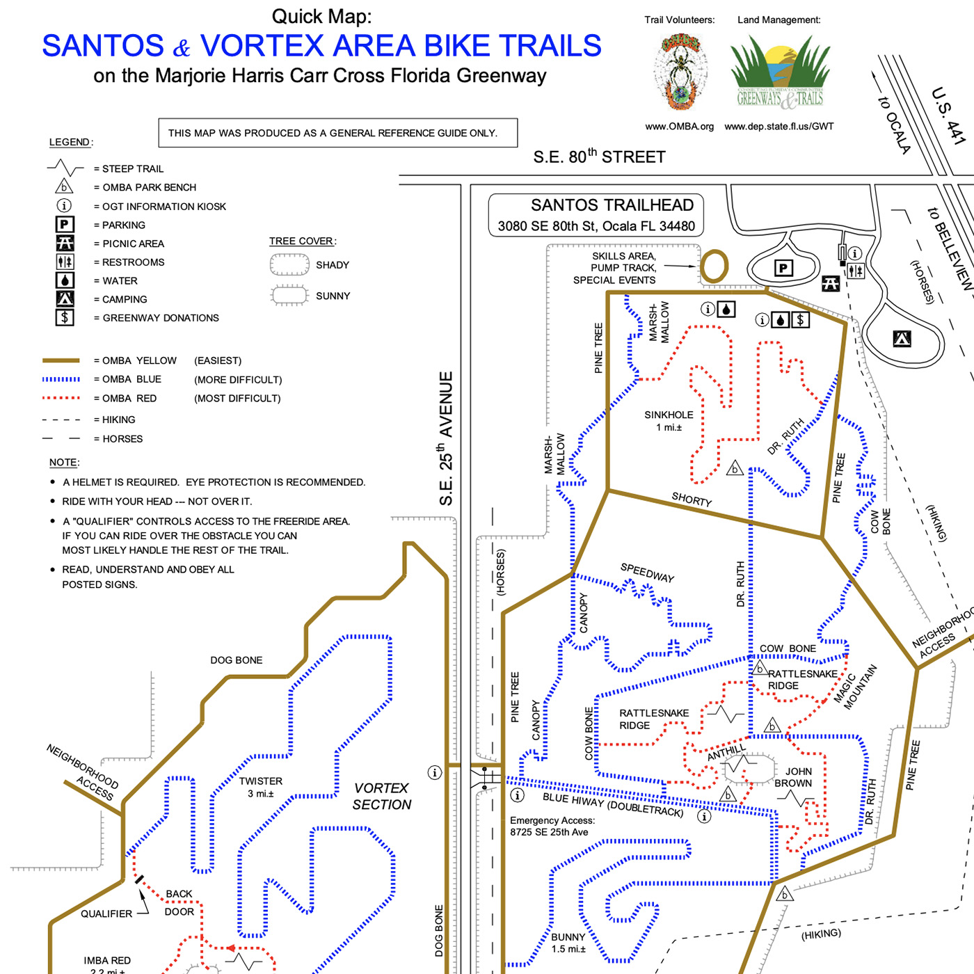
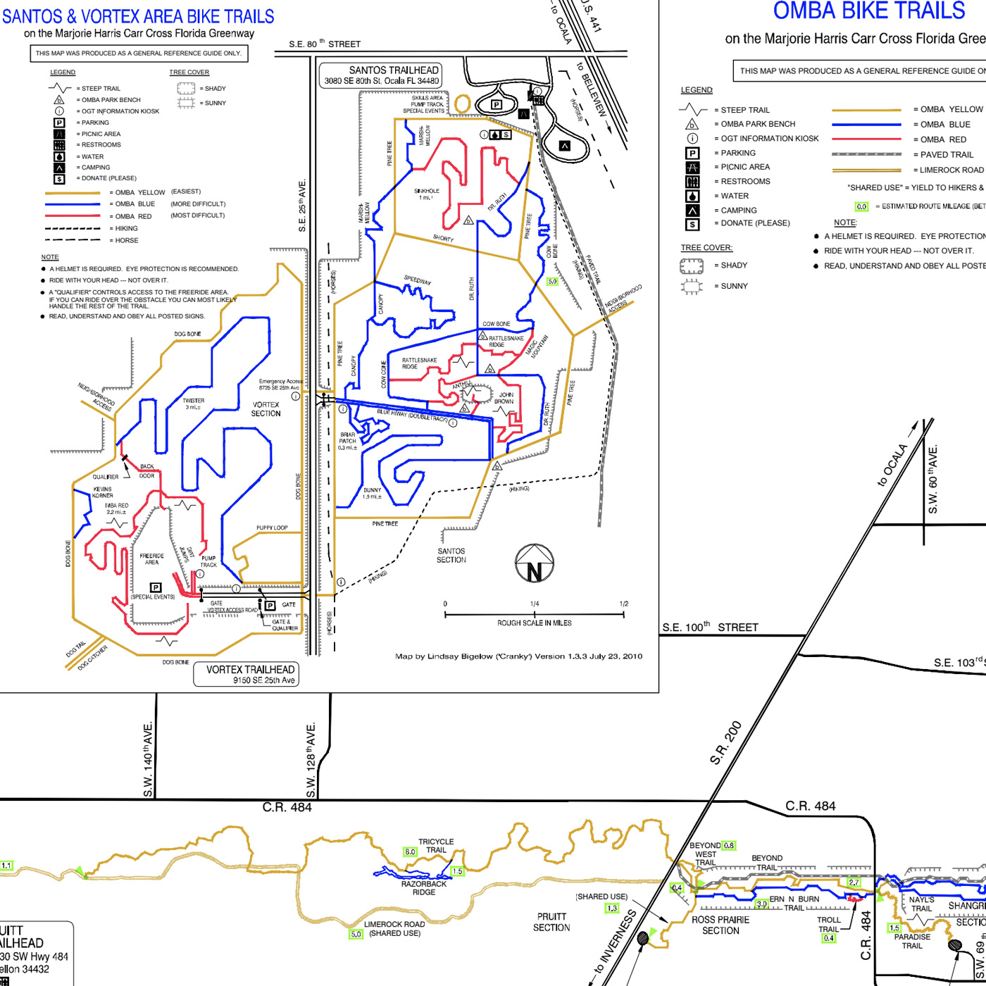
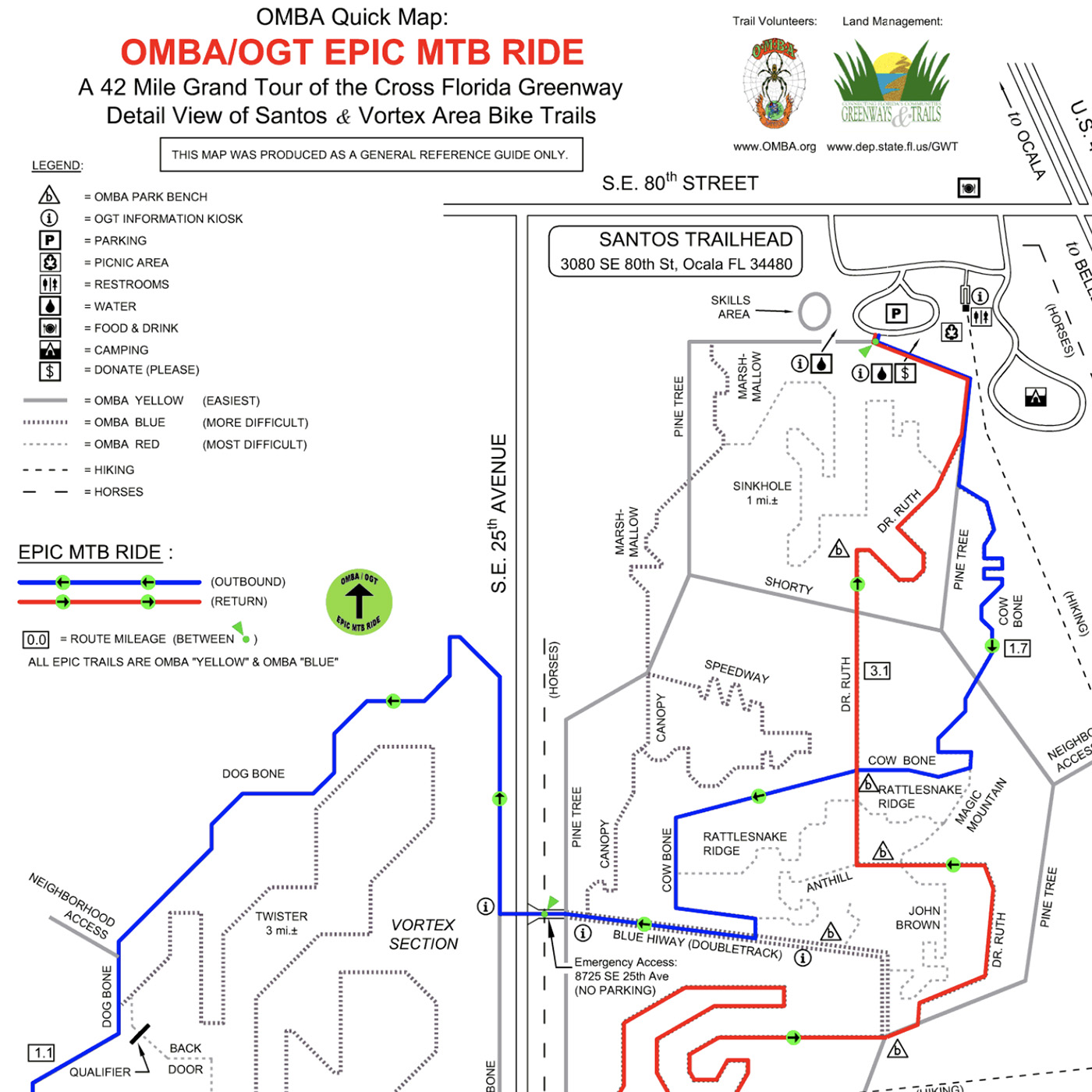
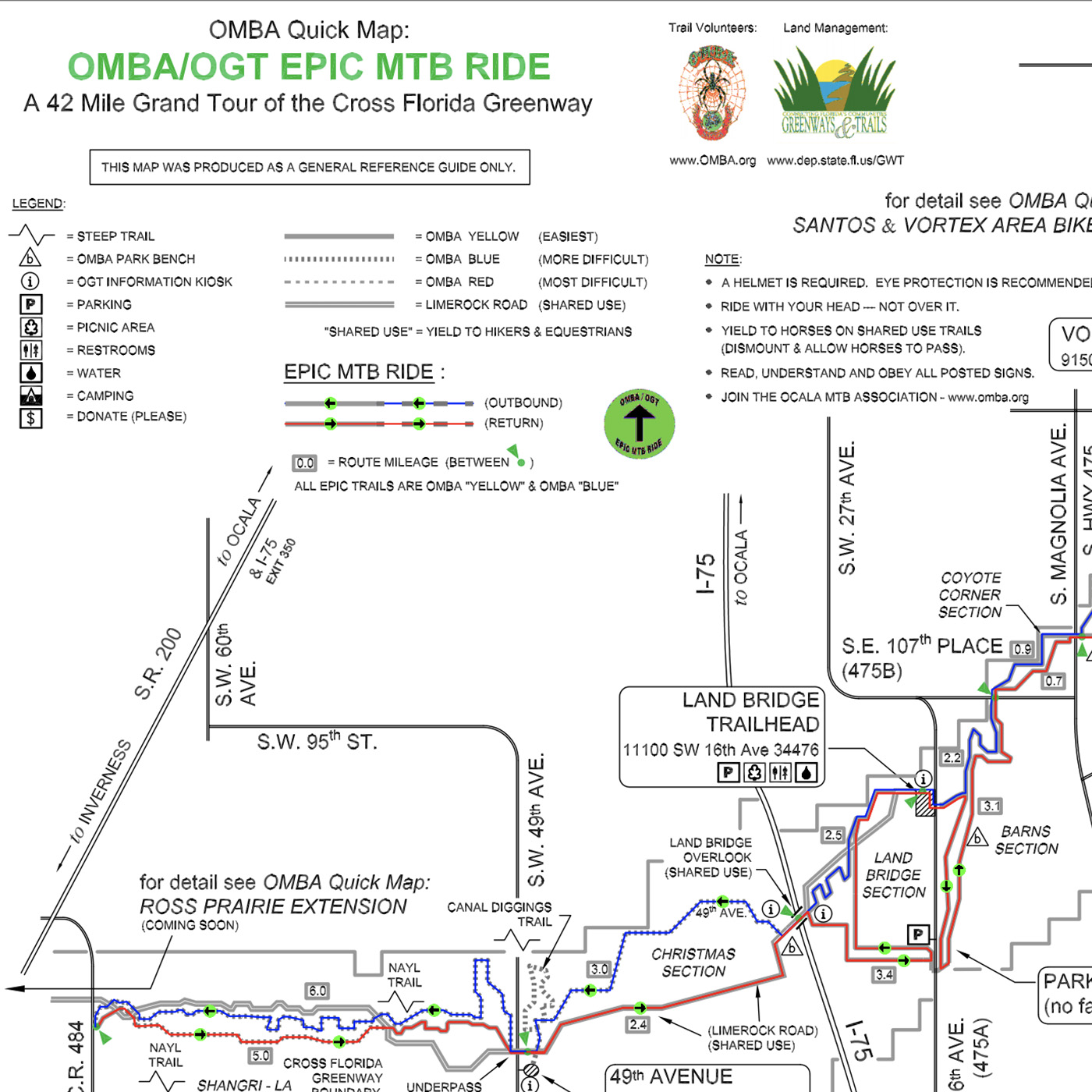
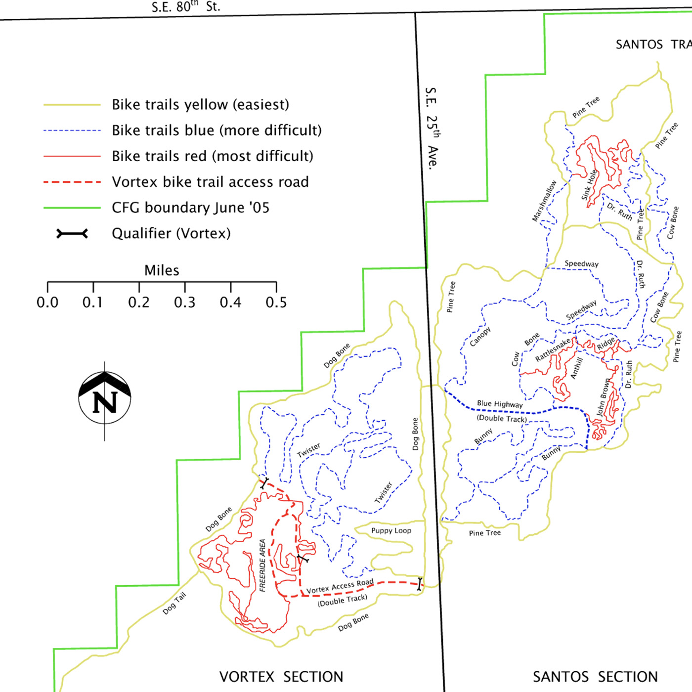
Quick Maps:
Schematic maps which are easy to print, easy to read and make it easy to find your bearings. When you're out on the trail, these are what you want with you.
OMBA EPIC Maps:
The Office of Greenways and Trails received the IMBA designation of "Epic Ride" for its Cross Florida Greenway Santos Trail System. One of only three sites designated in 2006, the Santos trails join an elite list of only 40 rides named as "Epic" by IMBA since 1999. This is a 42 mile ride if you choose to do the whole thing.
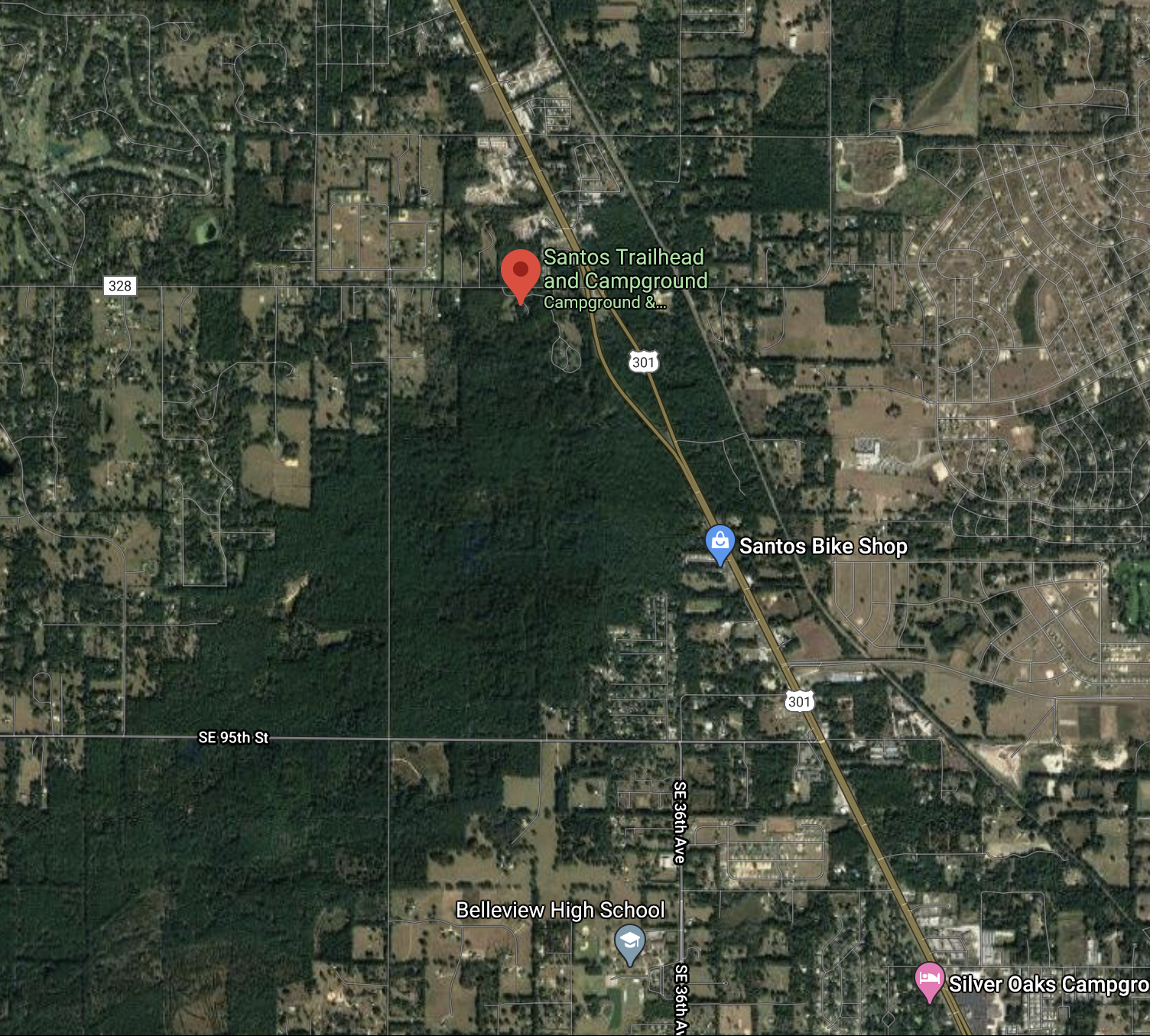
Google Maps:
Google Maps gives you lots of features, such as driving directions to the trailheads. You can also see the trails in their natural terrain. Made by Lindsay Bigelow (based on GPS data contributed by OMBA members and others).
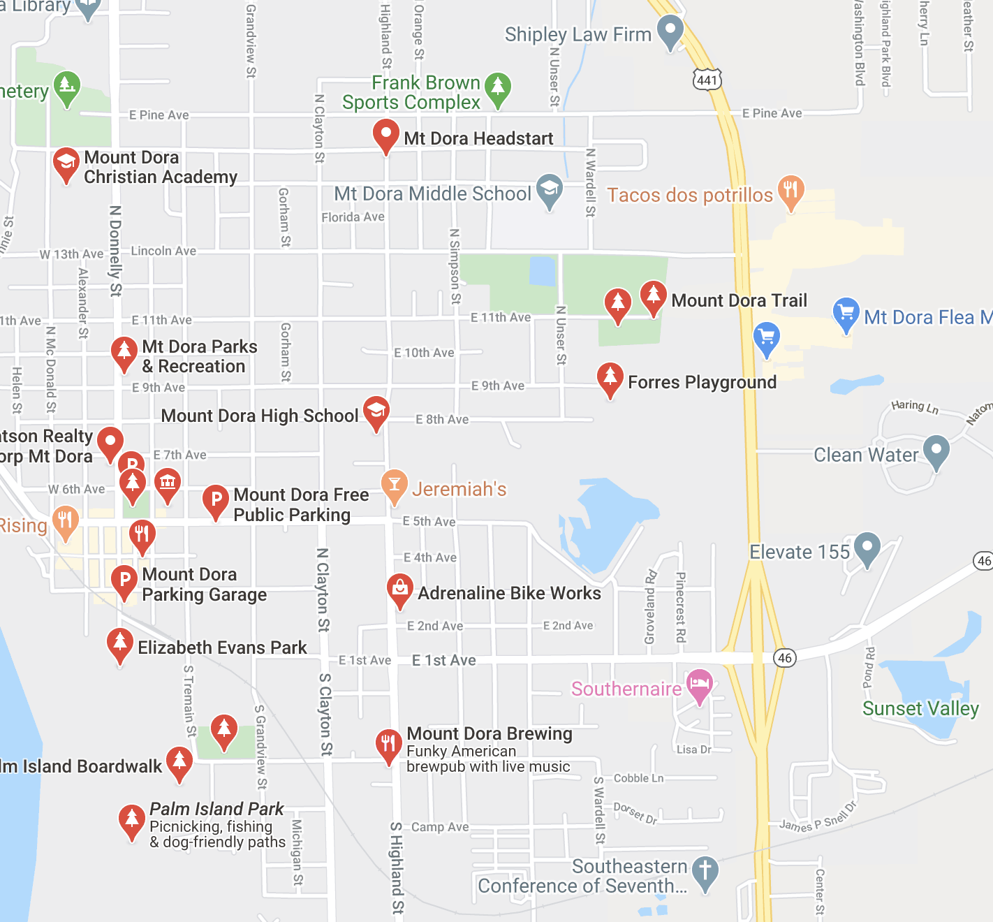
MT DORA:
Mt Dora on Google Maps gives you lots of features, such as driving directions to the trailheads.
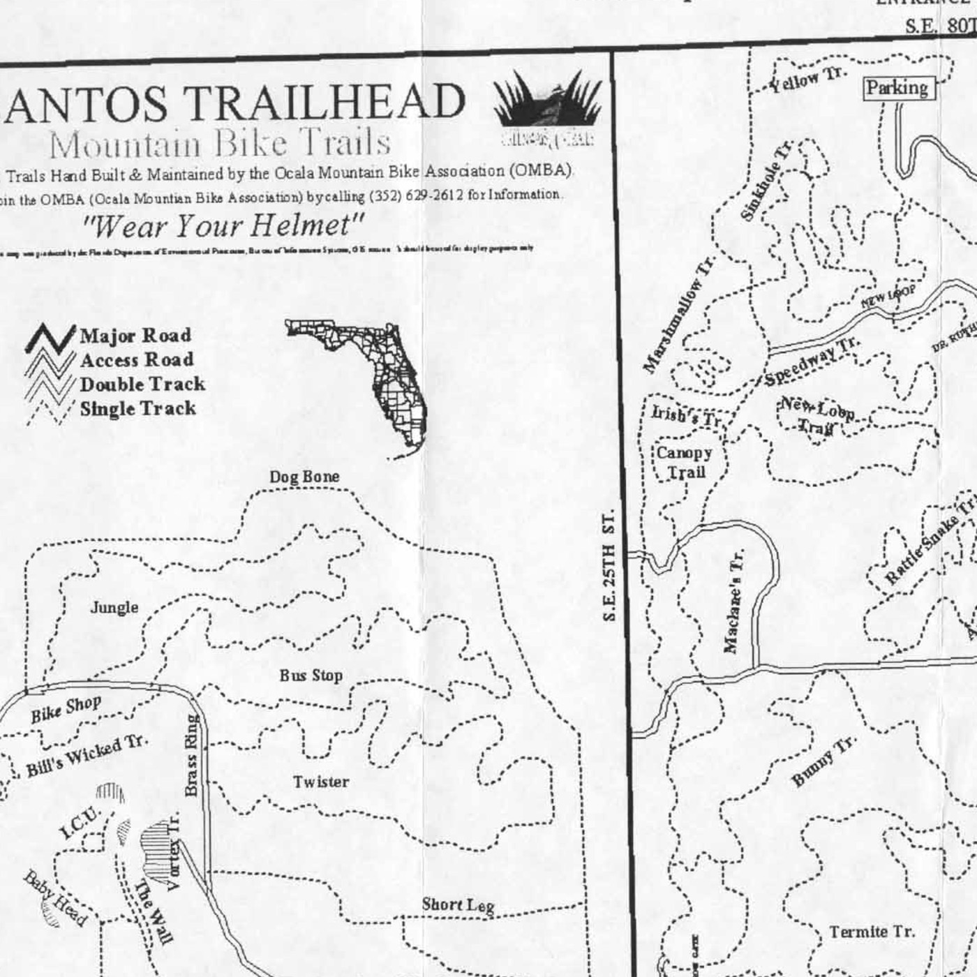
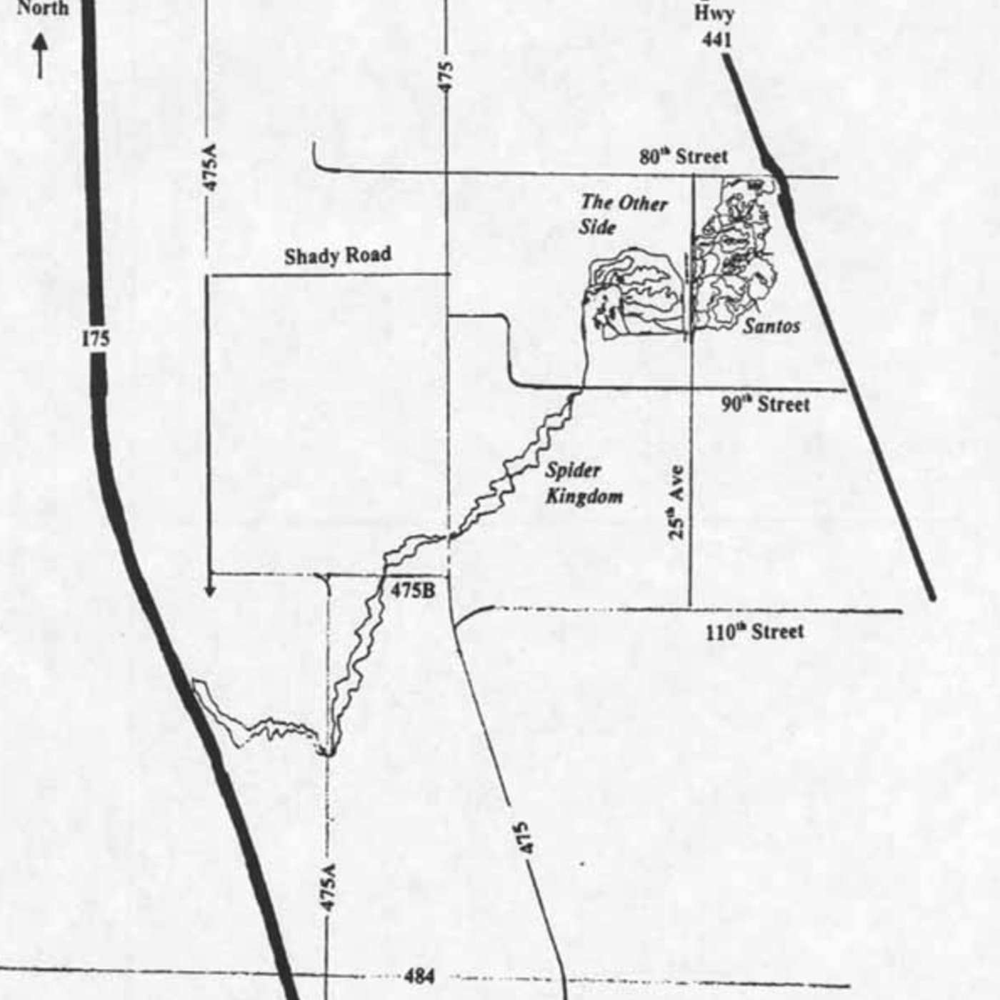
The Original Santos Maps:
Here are some older maps which some of you are familiar with from the 'old days' at Santos. It's kind of interesting to see how things have changed over time.
NOTE: These maps were created before the days of GPS. Which makes their accuracy all the more amazing!
NOTE: These maps were created before the days of GPS. Which makes their accuracy all the more amazing!